

Petroleum geoscience is the study of petroleum using all sciences related to its nature, search, recovery and management. It is a field that covers the various areas of petroleum exploration and production, from its generation through migration and accumulation. It integrates the core fields of geology and geophysics, such as sedimentary, structural geology, stratigraphy and related courses of geochemistry, petrophysics, and their application in mainstream petroleum exploration and production.
Petroleum Geosciences interest is in the basic material from which petrol is formed. This material, known as kerogen, is found is source rocks, that is parent rocks of petroleum. Petroleum geoscience personnel or geoscientist play major role in petroleum exploration and production.
The geoscientist evaluates different kinds of source rocks, their content and their maturity.
- Shale source rocks
- Kerogen types
- Maturity
Mature sources rocks are expected to have expulsed their hydrocarbons through career strata to accumulate in some reservoirs.
The geoscientist evaluates the presence and properties of reservoirs:
- Sandstone reservoirs
- Carbonate reservoirs
- Their porosity and permeability
Good reservoirs in petroleum systems would likely have accumulated some oil and gas as pools in suitable traps. Traps a created by adequate structural arrangements and seals.
- Mudrocks
- Evaporiste seals
- Pressure seals
- Structural and stratigraphic traps
S/he evaluates the intrinsic nature of seals, such as the roles of stress and pressure. Efficient seals with structural integrity will and have retained petroleum pools in traps for geological years, millions of years, such that they are available for drilling today.
The full process in the petroleum industry involves the evaluation of the other factors that determine the drillability of the available resources, and the management of the petroleum well in the post drilling phase. Petroleum geosciences department in oil industries carry out hydrocarbon prospect evaluation, reservoir seal assessment, well geologic and petrophysics studies, and formation evaluation, all which covered is covered in the Integratee Elvee Services (IESOG) training and services.
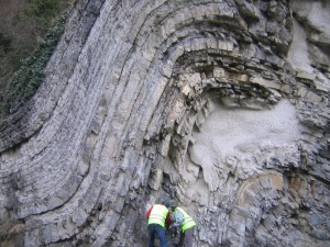
IESOG trainings cut across the various aspects of petroleum geosciences. In practice geologist and geophysicists start the initials studies by looking as geologic and remote sensing maps, visiting exposed rock samples as analogues to the subsurface conditions, carrying out seismic acquisitions and processing the signals. They interpret the structures and sedimentary profiles and test collected samples in the laboratory.
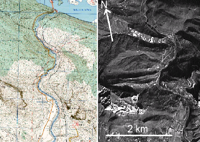
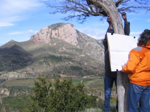
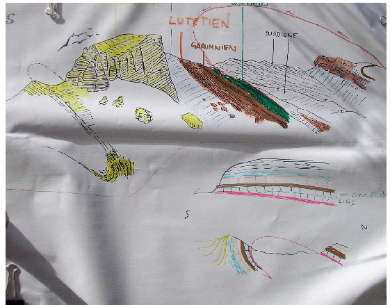
In combination with other techniques, the geologists also attempt to reconstruct geologic history based on field observations. Such observation will highlight the conditions of the rock in both the surface and the subsurface – that is, under the ground.
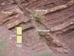
In Geoscience, the place where a rock is ‘broken’ is known as a ‘fracture’, and if shifted it is known as a ‘fault’. A fault has a fault wall on either sides and a gouge in the area of breakage.
The amount of shift is known as fault ‘displacement’.
In modern days, the use of seismic acquisition helps to provide near accurate images of the subsurface, understandable and interpretable by geologist and geophysicists. A seismic image is produced by sending waves (sounds) in the subsurface and measuring their pattern of reflection (amplitudes, frequency, wavelengths…) to give indications of the nature of the reflecting surface beneath the ground.
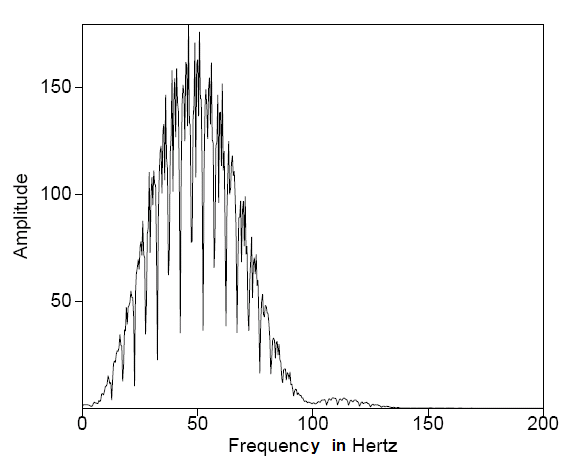
With the speed and time of arrival of the reflection, geophysicists are able to produce seismic images showing flat and slanted surfaces under the ground.
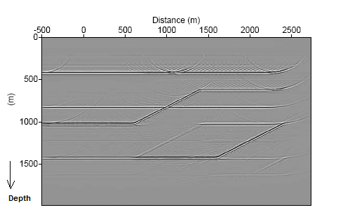
Apart from the macroscopic interpretations, the large panoramic interpretations and seismic images covering a landscape, there are microscopic studies necessary for the understanding of rock properties and how hydrocarbon fluid flow within them. One of such concerns is on how oil migrates through less permeable rocks into the porous one known as reservoir where they are stored and drilled.
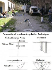
Borehole Seismic Training showing the principle of VSP
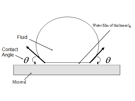
Contact Angle for capillary pressure estimation
If a well is already drilled, seismic images can be produced by putting the sensors that record the seismic signal in the hole. This seismic survey, known as vertical seismic profile or VSP, gives more precise images for the subsurface.
There is a concern about pressure movement within rocks, through tiny holes known as pore-throat. This movement is controlled by pressures in the subsurface. The larger the pores, the more the rock is said to have high porosity.
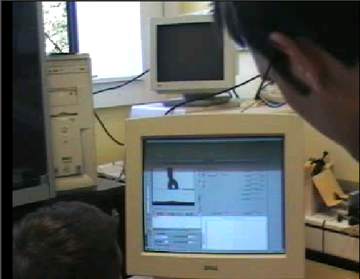
Contact Angle measurement in the lab
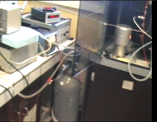
Contact Angle measurement set up
For more information of Petroleum Geoscience, please consult the the IESOG Petroleum Geoscience Book Series.